DEM Earth 6 can now read and interpret GeoTiffs.
- GeoTiffs are no longer relevant in this context as geotiff is the defacto standard for height data.
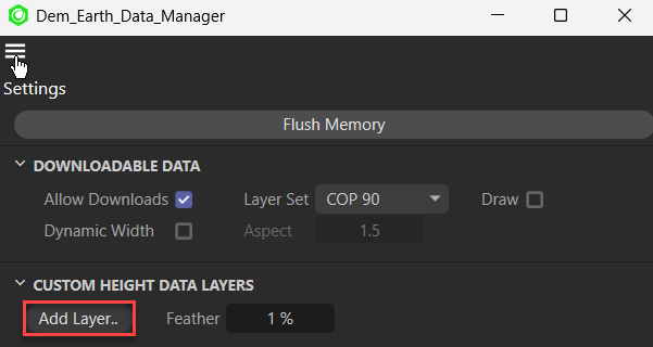
- To use a Geotiff gor height data, you add it as a layer from the Data manager.
- DEM Earth read the Geotiff header, but it uses c4d's tiff loader.
- C4D's tiff loader is limited to files of 4GB or less.
- The Geotiff has to have the projection EPSG:4326 if is not the right projection, you can either repreject it yourself in QGIS, or global mapper, or link DEM Earth to your QGIS install to automatically reproject anything to 4326.
The advantage of ASC, is that there is no limit to its resolution. However the file sizes tend to be huge. If you have height data sampled at 1m or even 50cm, such as Lidar, you can convert it to ASC and easily use it with DEM Earth.
ASC embedding, embeds raw data into DEM Earth. This makes it possible for you to use height data from many sources, both high and low res, as long as it has the following characteristics.
- WGS84 datum
- geographic projection
- EPSG:4326
- not so large that it will fit into available ram.
the advantage of ASC is that its a simple, wide spread format and with it DEM Earth can make use of any kind of height data available.
If you have height data in some other format, use a GIS application such as Global Mapper to re-project the data, and save it out as gridded asc , in geographic coordinates.
- We offer a service for data re-projection. We can convert almost any format or projection from, and to, just about anything. From a few MB to a several terabytes.
- Got Lidar data ? Can't get it into C4D? We can help.
- Contact support for further information.